← Back to the ranking

Mauá

SP · Southeast

Population: 429,064 (IBGE estimate 2026)

About Mauá

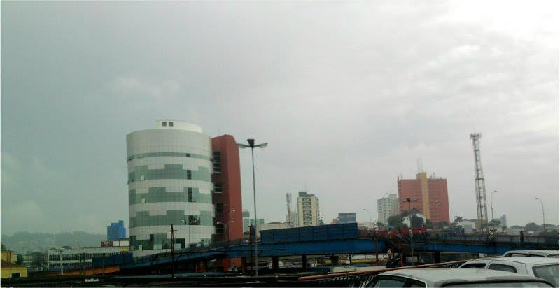
Photo of Mauá
Photo: Renato LZ · Public domain · Wikimedia Commons

Machine translation of the Portuguese Wikipedia article (November 2026 version).

Mauá is a municipality in the Metropolitan Region of São Paulo, in the state of São Paulo, Brazil. It belongs to the ABC Paulista region, in the Southeast Zone of Greater São Paulo, in accordance with state law No. 1,139 of June 16, 2011 and, consequently, with the Integrated Urban Development Plan of the Metropolitan Region of São Paulo (PDUI). The population density is 6,753.01 inhabitants per square kilometer. However, the urban density is much higher, since a third of the municipality is industrial area and 10% belongs to the rural area and the Serra do Mar State Park. In 2014 it was the 20th municipality in the state by gross domestic product. With 418,261 inhabitants (2022 Census), Mauá is the 15th most populous municipality in the state of São Paulo and the 57th most populous in Brazil.

The municipality of Mauá was named in honor of Irineu Evangelista de Sousa, the “Baron of Mauá”, an important businessman and industrialist of the Empire of Brazil. The name derives from Mauá Station, opened in 1867 by the São Paulo Railway, a railway associated with the industrial and railway development driven by the Baron of Mauá. The station gave rise to the urban nucleus that later developed into the present-day municipality.

Text: Wikipedia · CC BY-SA 4.0 · Read the full article on Wikipedia (in Portuguese)
Videos on YouTube

Each button opens YouTube in a new tab, already searching.

Attractions nearby

Well-known places within 50 km of the city center, closest first. Source: Wikidata (public domain).

Scores by topic

0 to 100, compared with Brazilian municipalities of 100,000+ residents (rent: compared among the 36 cities with rent data).

Cost of living

No rent data

Rent data (FipeZAP) covers 36 cities. Here the cost topic counts as average (50) in the score.

Healthcare

22

SP average (81 cities): 35 · All 338 cities: 34

Hospital beds per 1,000

1.16 per 1,000 residents

Source: CNES / DATASUS (TabNet) · Reference: Sep 2026 · License: Public data

Doctors per 1,000

2.72 per 1,000 residents

Source: CNES / DATASUS (TabNet) · Reference: Sep 2026 · License: Public data

Airport access

99

SP average (81 cities): 79 · All 338 cities: 60

Distance to intl. airport (km)

26.08 km

Source: ANAC – Voo Regular Ativo e Aeródromos · Reference: Sep 2025–Aug 2026 · License: Open data

International departures within 100 km

41,330 departures in 12 months

Source: ANAC – Voo Regular Ativo e Aeródromos · Reference: Sep 2025–Aug 2026 · License: Open data

Nearest international airport

Guarulhos - Governador André Franco Montoro (SBGR), 26 km in a straight line · 41,330 international departures in 12 months

Social Progress Index (overall)

65.1

score 0–100 · Source: Índice de Progresso Social Brasil · Reference: SPI Brazil 2026 (2024 data) · License: CC BY 4.0 (report)

Climate month by month

Mild Average temperature: 21.1 °C (Average temperature below 22 °C (72 °F))

10 15 20 25 30 35 °C 0100200300 mm Jan: 269 mm Feb: 225 mm Mar: 204 mm Apr: 87 mm May: 79 mm Jun: 42 mm Jul: 49 mm Aug: 32 mm Sep: 89 mm Oct: 123 mm Nov: 135 mm Dec: 227 mm Jan: 29.2 °CFeb: 29.4 °CMar: 28.5 °CApr: 26.9 °CMay: 23.9 °CJun: 23 °CJul: 22.8 °CAug: 24.5 °CSep: 24.8 °COct: 26.6 °CNov: 27.6 °CDec: 28.4 °C Jan: 19.1 °CFeb: 19.2 °CMar: 18.6 °CApr: 17.1 °CMay: 14.3 °CJun: 12.5 °CJul: 12 °CAug: 12.7 °CSep: 14.1 °COct: 15.8 °CNov: 16.9 °CDec: 18.1 °C JanFebMarAprMayJunJulAugSepOctNovDec
Avg. high (°C) Avg. low (°C) Rain (mm)
Show monthly table
Month JanFebMarAprMayJunJulAugSepOctNovDec
Avg. high (°C) 29.229.428.526.923.923.022.824.524.826.627.628.4
Avg. low (°C) 19.119.218.617.114.312.512.012.714.115.816.918.1
Rain (mm) 269225204877942493289123135227

Weather station Guarulhos, 23 km away · climate normals 1981-2010 · Source: INMET Normais Climatológicas · License: Public data

Location

Nearby cities

Up to 150 km in a straight line. Scores use your weights.

  1. Ribeirão Pires SP · 7 km 63
  2. Santo André SP · 7 km 68
  3. São Bernardo do Campo SP · 10 km 72
  4. São Caetano do Sul SP · 12 km 85
  5. Diadema SP · 15 km 64
  6. Ferraz de Vasconcelos SP · 17 km 57

Cities with a similar profile

Topic scores closest to those of Mauá. Scores use your weights.

  1. Taboão da Serra SP · Southeast 61
  2. Suzano SP · Southeast 59
  3. Embu das Artes SP · Southeast 58
  4. Mogi das Cruzes SP · Southeast 64
  5. Guarulhos SP · Southeast 66
  6. Votorantim SP · Southeast 62

Spotted an error? Tell us · Wrong number or outdated data? Tell us which one and, if you can, the source.